EN
IT
Home
About us
Services
Projects
Contacts
Studio Topografico Fossati
400kV LASTVA-CEVO POWER LINES
ENGINEERING (for tender purpouse)
BACK TO PROJECT LIST
Client:
TECNOLINES
Country:
MONTENEGRO
Year:
2013
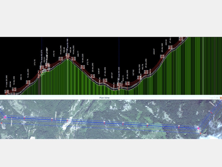
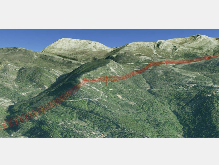
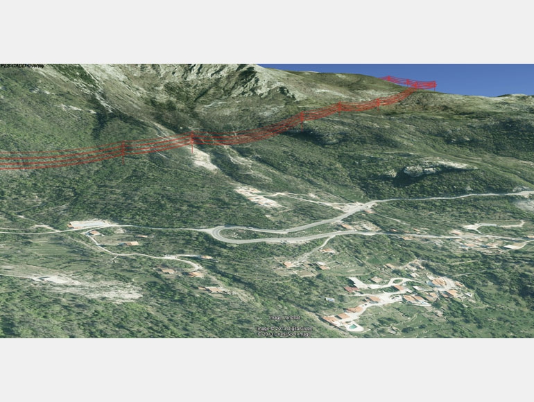
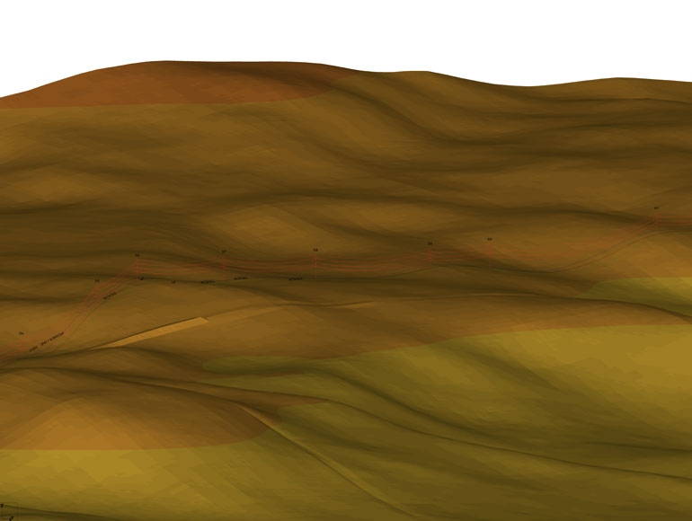
Satellite images processing and line route defi
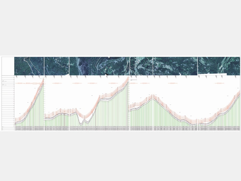
Extraction of the elevation profile along the line route from Digital Terrain Model
Identification of existing interferences such as roads, power lines, rivers, railways, buildings, etc.
Creating PLS-CADD model with land data: satellite imagery, DEM and interference identified.
Creating the database project in PLS-CADD which environmental load, types of conductors, different types of structures with their cpabilities..
Tower spotting, stacking chart and material list
ASK FOR A QUOTE
Need a quote for a service? Contact us for a free custom quote.
Contact us
Questo sito web utilizza i cookie per migliorare la navigazione. Utilizzando il sito si intende accettata la Cookies Policy.
Maggiori informazioni
OK