PLS-CADD software

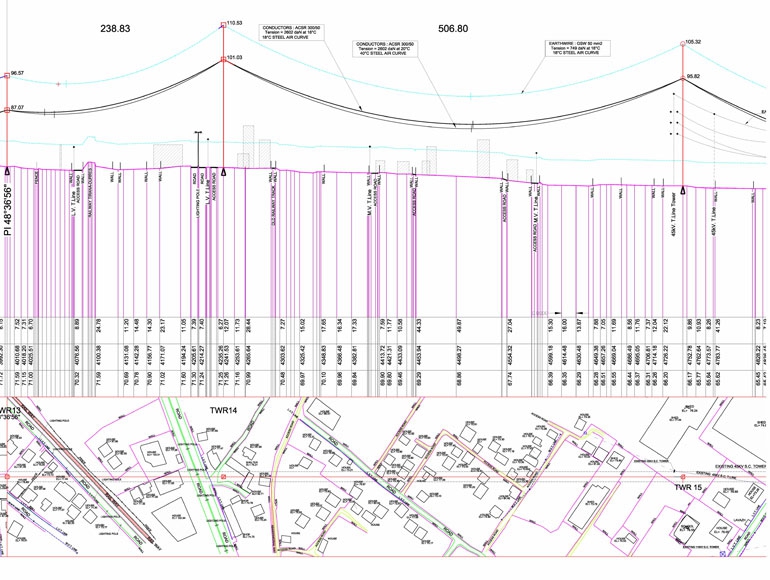
    Many years of experience in the Transmission Line Design using the PLS-CADD software. We provide a valuable support for all project phases of power lines design from the topographical survey up to the elaboration of AS-Built drawings.
    The activities in detail are:


  • Insertion of topographical map, satellite images, digital orthophotos, etc..

  • Iinsertion and assignment codes to survey data collected by traditional surveying equipment like GPS and Toal station.

  • Insertion and assignment codes to survey data collected by modern electronic surveying equipment and mapping techniques as Lidar, Photogrammetry, Laser Scann....

  • Creating the elevation profile along the axis of the line with the relative "side profile" and all the interference.

  • Creating database with the environmental and load design criteria as:
  • -- Weather cases
    -- Code specific and terrain parameters
    -- Creep and permanent stretch
    -- ACSR cable model
    -- Cable tensions
    -- Maximum tensions
    -- Weight span model
    -- Conditions for checking span and structures
    -- Structure loads criteria 
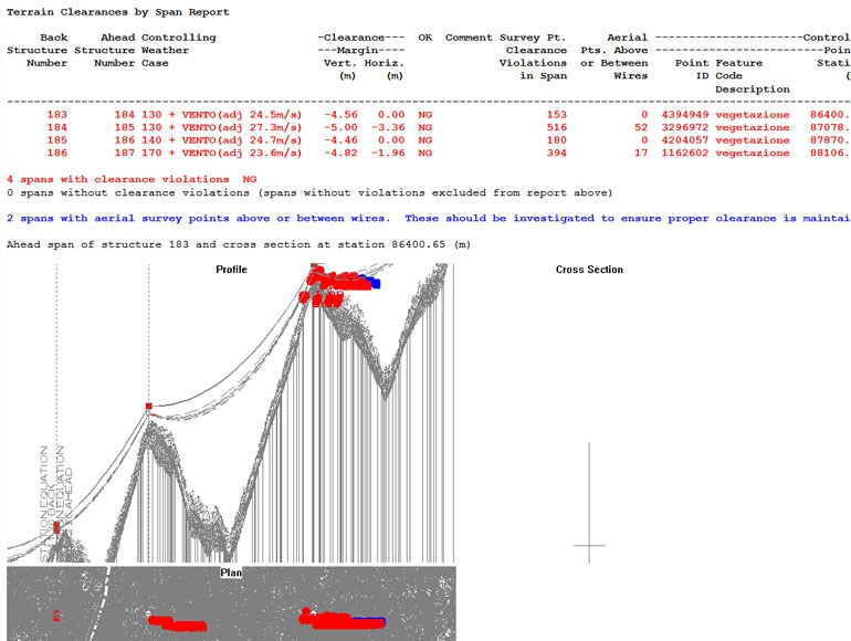
    -- Condition fot checking clearances
    -- Fine element modelling data
    -- and more....

  •  Sag and tension calculation for conductor, earth wire, OPGW..

  • Creating database structures with:
  • -- Structure geometry and equipments(cable sets,insulator type..)
    -- Structure strenght (allowable spans, wind span, weight span..)


  •  Automatic or interactive structure optimum spotting.

  • Cables and structure checking with design and clearance limits.

  • Stacking Chart and Material tables, Plan and Profile drawings

  • AS-BUILT drawings 


ASK FOR A QUOTE

Need a quote for a service? Contact us for a free custom quote.

Contact us