- EN
- IT
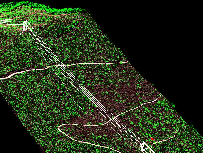
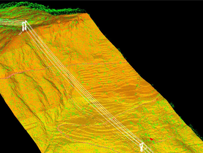
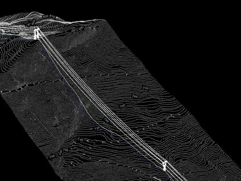
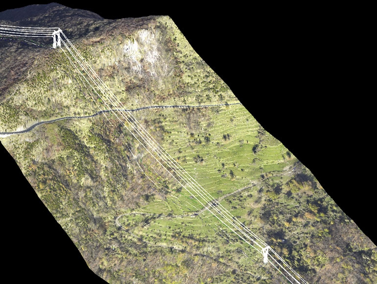
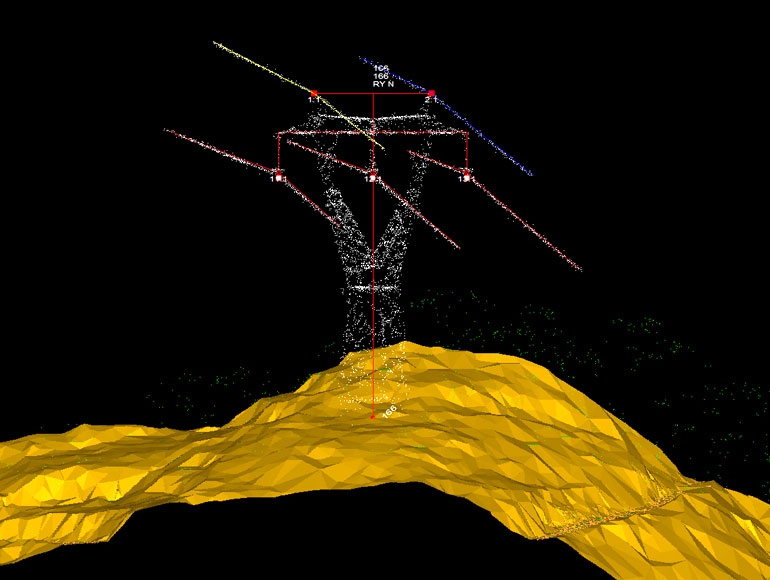
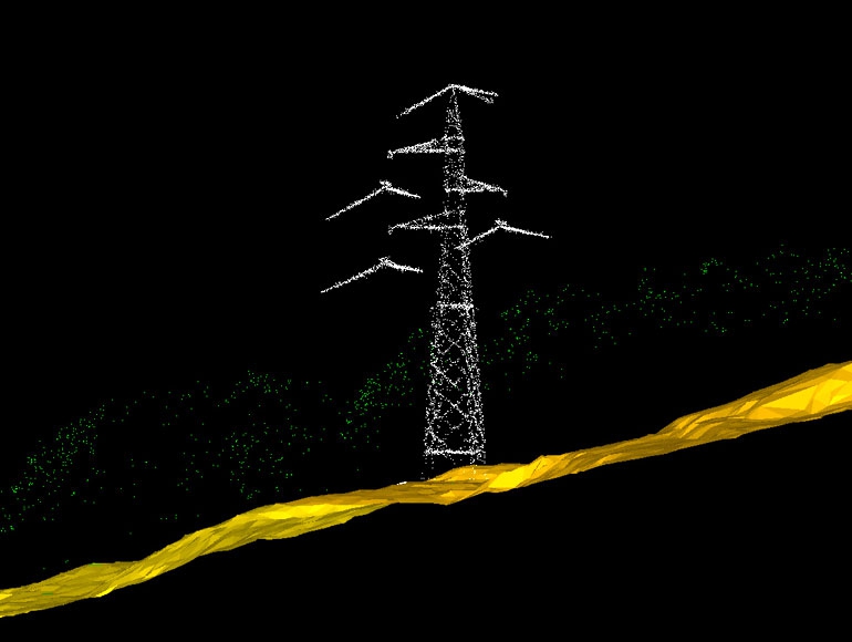
Extensive experience in providing high precision topographical surveys for transmission line.We provide surveys by using the traditional equipments as GPS and total stations but also using the latest innovative techniques and instrumentation such as the use of aerial drones (UAV) for photogrammetry and the 3D laser scanning device.
This allows us to increase the volumes of data required in a shortest time and ensuring the same high accuracy at very low cost to our customer.
The main activities that we perform are: